
Project Description
In 2020, Ruekert & Mielke, Inc (R/M) provided surveying services for the siting of a potential solar farm development in a rural Wisconsin community. With an expedited timeline, the R/M survey team worked to offer a comprehensive survey and analysis.
Under time constraints, our team managed to collect all necessary data and provide final deliverables to the client. In two drone flights performed over two days, through managing crop harvest times, unexpected Wisconsin weather, and an uncooperative landowner, all requested field deliverables were collected.
Drone surveys ensured that data points were collected quickly and without the need to step foot on neighboring properties to cause potential disturbances. Flights began in early December and all deliverables were ready and in the hands of the client by early January.
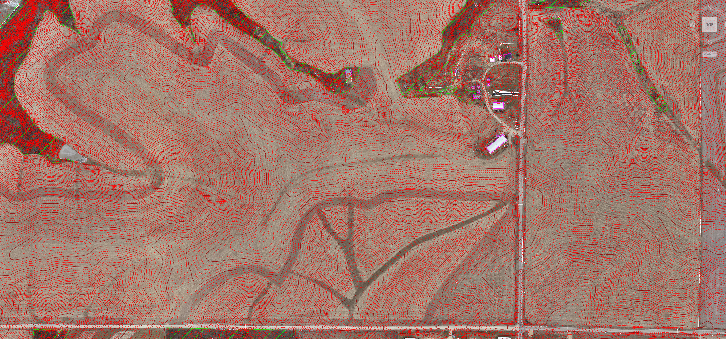
R/M’s work on the project included GPS conventional survey, base map preparation, and data processing to generate a base map. The survey work included orthophoto collection, DTM/DEM creation, and planimetric line work of all buildings and farmsteads within the project areas, which were sent electronically as CAD and MrSID files.
Our experts offered additional resources to assist if the project is approved, providing an all-in-one environmental and survey crew - not just a one-service contractor to provide data points. Deliverables were provided quickly, without disruption, and our team was able to react with flexibility to suit the availability of the site due to seasonal conditions and contestable landowners. R/M’s quick response time, collection time, and efficient use of manpower made for quality deliverables compared to traditional methods.
Services Provided
UAS/Drone Survey
Orthophoto Collection
GPS Conventional Survey
Planimetrics
DEM/DTM Creation